
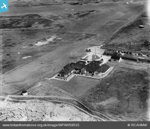
WPW058515 WALES (1938). View of Royal Porthcawl golf couse and clubhouse, oblique aerial view. 5"x4" black and white glass plate negative.
© Copyright OpenStreetMap contributors and licensed by the OpenStreetMap Foundation. 2024. Cartography is licensed as CC BY-SA.
Nearby Images (13)
WAW006968

WAW006969

WAW006970

WAW036210

WAW036211

WPW058515

WPW058516

WPW058517

WPW058518

WPW058519

WPW058520

WPW058521

WPW058522

Details
| Title | [WPW058515] View of Royal Porthcawl golf couse and clubhouse, oblique aerial view. 5"x4" black and white glass plate negative. |
| Reference | WPW058515 |
| Date | 6-August-1938 |
| Link | Coflein Archive Item 6370444 |
| Place name | |
| Parish | |
| District | |
| Country | WALES |
| Easting / Northing | 280246, 178386 |
| Longitude / Latitude | -3.7251383907856, 51.491237138699 |
| National Grid Reference | SS802784 |
Pins
Be the first to add a comment to this image!
User Comment Contributions
 The Club was formed in 1891 with only nine holes. Subsequently, further land was leased in 1895 and the original nine holes abandoned when the clubhouse and 18 holes were built. The club received its greatest honour in 1909, when it was bestowed the rare privilege to use the prefix “Royal” |
 royalfixit |
Wednesday 27th of June 2012 06:08:50 AM |


