
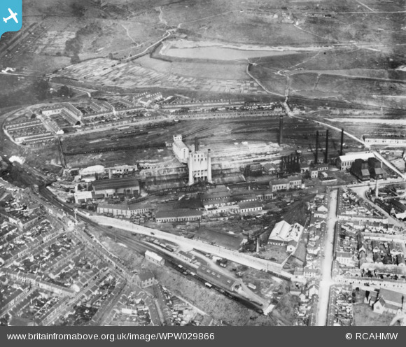
WPW029866 WALES (1929). View of Ivor Ironworks, Dowlais. Oblique aerial photograph, 5"x4" BW glass plate.
© Copyright OpenStreetMap contributors and licensed by the OpenStreetMap Foundation. 2024. Cartography is licensed as CC BY-SA.
Details
| Title | [WPW029866] View of Ivor Ironworks, Dowlais. Oblique aerial photograph, 5"x4" BW glass plate. |
| Reference | WPW029866 |
| Date | 1929 |
| Link | Coflein Archive Item 6422656 |
| Place name | |
| Parish | |
| District | |
| Country | WALES |
| Easting / Northing | 306600, 208200 |
| Longitude / Latitude | -3.3535743323944, 51.764228433213 |
| National Grid Reference | SO066082 |
Pins

User Comment Contributions
I was lucky enough to have two school visits to this works in the 1960's and I just wish that I remembered more of those days. I revisited the area last month and took some photos which I would hope to upload when the opportunity arises. |
 Class31 |
Friday 10th of October 2014 04:26:20 PM |


