
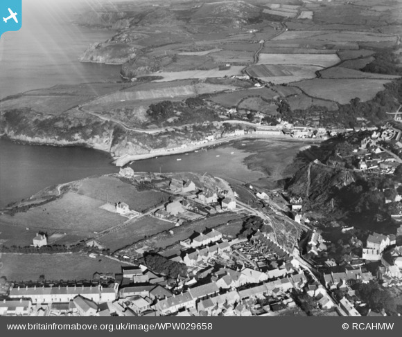
WPW029658 WALES (1929). View of Fishguard & Goodwick Harbour, oblique aerial view. 5"x4" black and white glass plate negative.
© Copyright OpenStreetMap contributors and licensed by the OpenStreetMap Foundation. 2024. Cartography is licensed as CC BY-SA.
Nearby Images (6)
WPW029654

WPW029655

WPW029656

WPW029657

WPW029658

WPW040071

Details
| Title | [WPW029658] View of Fishguard & Goodwick Harbour, oblique aerial view. 5"x4" black and white glass plate negative. |
| Reference | WPW029658 |
| Date | 1929 |
| Link | Coflein Archive Item 6370602 |
| Place name | |
| Parish | |
| District | |
| Country | WALES |
| Easting / Northing | 195140, 238750 |
| Longitude / Latitude | -4.985303134253, 52.008888390505 |
| National Grid Reference | SM951388 |
Pins
 DeborahWales |
Friday 2nd of October 2020 04:30:40 PM | |
DeborahWales |
Friday 2nd of October 2020 04:29:19 PM | |
DeborahWales |
Friday 2nd of October 2020 04:27:19 PM | |
Mac |
Monday 20th of May 2013 05:28:21 PM | |
 Class31 |
Thursday 1st of November 2012 07:13:09 PM | |
Class31 |
Thursday 1st of November 2012 07:12:33 PM | |
Class31 |
Thursday 1st of November 2012 07:12:13 PM | |
Class31 |
Thursday 1st of November 2012 07:11:51 PM |


