
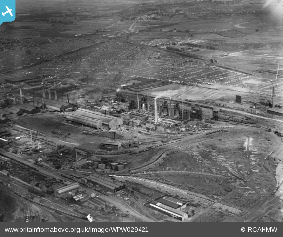
WPW029421 WALES (1929). View of Cardiff showing East Moors Works and Splott., oblique aerial view. 5"x4" black and white glass plate negative.
© Copyright OpenStreetMap contributors and licensed by the OpenStreetMap Foundation. 2024. Cartography is licensed as CC BY-SA.
Nearby Images (17)
WAW025125

WAW025126

WAW025127

WAW025128

WAW025129

WAW025130

WAW025131

WAW025132

WAW025133

WAW025134

WAW025135

WPW029421

WPW029861

WPW029863

WPW029877

WPW051853

WPW051861

Details
| Title | [WPW029421] View of Cardiff showing East Moors Works and Splott., oblique aerial view. 5"x4" black and white glass plate negative. |
| Reference | WPW029421 |
| Date | 1929 |
| Link | Coflein Archive Item 6378031 |
| Place name | |
| Parish | |
| District | |
| Country | WALES |
| Easting / Northing | 319860, 175760 |
| Longitude / Latitude | -3.1540307882948, 51.474632513911 |
| National Grid Reference | ST199758 |
Pins
 me1onhead |
Saturday 9th of December 2023 12:45:58 PM | |
gBr |
Wednesday 14th of June 2017 03:05:49 PM | |
gBr |
Wednesday 14th of June 2017 02:50:07 PM | |
gBr |
Wednesday 14th of June 2017 02:09:50 PM | |
 Class31 |
Tuesday 29th of July 2014 08:25:56 AM | |
Class31 |
Tuesday 29th of July 2014 08:25:03 AM | |
Class31 |
Tuesday 29th of July 2014 08:24:21 AM | |
Class31 |
Tuesday 29th of July 2014 08:23:39 AM | |
Class31 |
Tuesday 29th of July 2014 08:22:47 AM | |
Class31 |
Tuesday 29th of July 2014 08:21:54 AM | |
Class31 |
Tuesday 22nd of January 2013 09:53:32 AM |


