
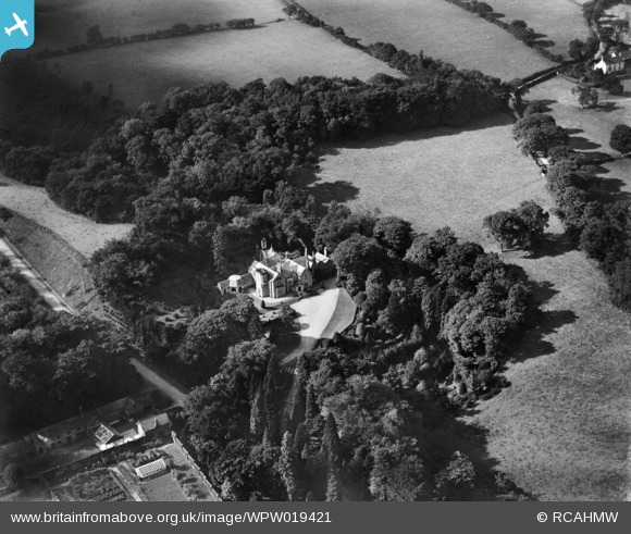
WPW019421 WALES (1927). View of Bronwylfa Hall, oblique aerial view. 5"x4" black and white glass plate negative.
© Copyright OpenStreetMap contributors and licensed by the OpenStreetMap Foundation. 2024. Cartography is licensed as CC BY-SA.
Nearby Images (10)
WPW019410

WPW019411

WPW019412

WPW019413

WPW019414

WPW019415

WPW019416

WPW019418

WPW019420

WPW019421

Details
| Title | [WPW019421] View of Bronwylfa Hall, oblique aerial view. 5"x4" black and white glass plate negative. |
| Reference | WPW019421 |
| Date | 1927 |
| Link | Coflein Archive Item 6378309 |
| Place name | |
| Parish | |
| District | |
| Country | WALES |
| Easting / Northing | 328290, 348280 |
| Longitude / Latitude | -3.06931786492, 53.02669212835 |
| National Grid Reference | SJ283483 |
Pins
 Class31 |
Sunday 30th of September 2012 10:58:44 PM | |
Class31 |
Tuesday 17th of July 2012 11:18:23 AM | |
My mothers aunt and uncle farmed here followed by her cousin and family. It was in the family until the early 80's |
 chops |
Saturday 15th of September 2012 08:12:31 PM |
Class31 |
Tuesday 17th of July 2012 11:18:08 AM |
User Comment Contributions
esclwysham hall |
chops |
Sunday 30th of September 2012 10:55:46 PM |
I have rechecked this photograph and the view is of Bronwylfa Hall and not Esclusham Hall which is situated approximately two kilometres eeast of this location. Bronwylfa Hall may be examined on Google maps from the air and is as shown in this image. There are a number of photographs of the same area which put Bronwylfa Hall in context. |
Class31 |
Sunday 30th of September 2012 10:55:46 PM |
A close up of Bronwylfa Hall about two miles West of Rhostyllen, Wrexham. View looking Nort West. Only Bronwylfa Hall and Cae Glas to enable identification but part of a group of photos of the area. |
Class31 |
Tuesday 17th of July 2012 11:21:54 AM |


