
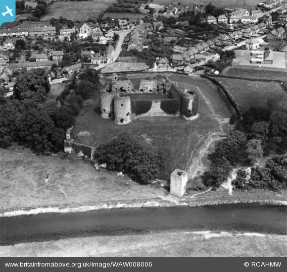
WAW008006 WALES (1947). View of Rhuddlan showing castle. Oblique aerial photograph, 5½" cut roll film.
© Copyright OpenStreetMap contributors and licensed by the OpenStreetMap Foundation. 2024. Cartography is licensed as CC BY-SA.
Nearby Images (9)
WAW008003

WAW008004

WAW008005

WAW008006

WAW008008

WAW008009

WPW018855

WAW008007

WPW018856

Details
| Title | [WAW008006] View of Rhuddlan showing castle. Oblique aerial photograph, 5½" cut roll film. |
| Reference | WAW008006 |
| Date | 30-June-1947 |
| Link | Coflein Archive Item 6422491 |
| Place name | |
| Parish | |
| District | |
| Country | WALES |
| Easting / Northing | 302340, 378120 |
| Longitude / Latitude | -3.4652626751322, 53.290758628797 |
| National Grid Reference | SJ023781 |
Pins
Be the first to add a comment to this image!


