
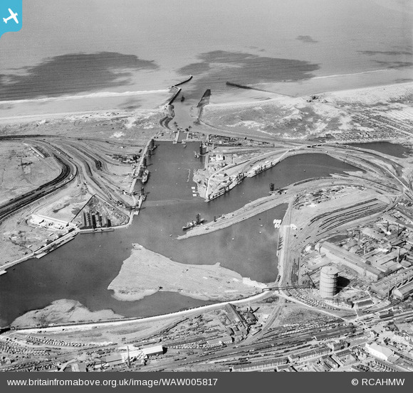
WAW005817 WALES (1947). General view of Port Talbot docks
© Copyright OpenStreetMap contributors and licensed by the OpenStreetMap Foundation. 2024. Cartography is licensed as CC BY-SA.
Nearby Images (37)
WAW005817

WAW005819

WAW005820

WAW005821

WAW005822

WAW005823

WAW005824

WAW005825

WAW005826

WAW005827

WAW006739

WAW006740

WAW006742

WAW006743

WAW006744

WAW006745

WAW006747

WAW007975

WAW007976

WAW007977

WAW026073

WAW026074

WAW026075

WAW026076

WAW026077

WAW026078

WAW026079

WAW026080

WAW026081

WAW026082

WPW043050

WPW043051

WPW043052

WPW043053

WPW043054

WPW043055

WPW043056

Details
| Title | [WAW005817] General view of Port Talbot docks |
| Reference | WAW005817 |
| Date | 19-May-1947 |
| Link | Coflein Archive Item 6413351 |
| Place name | |
| Parish | |
| District | |
| Country | WALES |
| Easting / Northing | 276000, 189000 |
| Longitude / Latitude | -3.7900131148748, 51.585721062159 |
| National Grid Reference | SS760890 |
Pins
 Rob Preston |
Thursday 21st of December 2017 08:20:24 AM | |
sloyne |
Thursday 23rd of July 2015 07:10:09 PM | |
sloyne |
Thursday 23rd of July 2015 07:04:53 PM | |
sloyne |
Thursday 23rd of July 2015 07:02:19 PM | |
sloyne |
Thursday 23rd of July 2015 07:01:18 PM | |
sloyne |
Thursday 23rd of July 2015 06:58:16 PM | |
sloyne |
Thursday 23rd of July 2015 06:56:23 PM | |
Paroak |
Tuesday 13th of January 2015 12:20:48 PM |


