
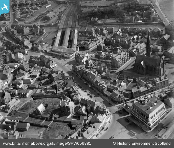
SPW056881 SCOTLAND (1938). Largs, general view, showing Main Street and Largs Station. An oblique aerial photograph taken facing south.
© Copyright OpenStreetMap contributors and licensed by the OpenStreetMap Foundation. 2024. Cartography is licensed as CC BY-SA.
Nearby Images (21)
SPW056881

SPW056877

SPW019554

SPW056878

SPW019553

SPW019555

SAR014822

SAR014823

SAR014824

SAR014825

SAR027694

SAR027695

SAR027696

SAR027697

SAR031667

SAW039354

SPW019557

SPW056880

SAW039355

SPW056873

SPW019556

Details
| Title | [SPW056881] Largs, general view, showing Main Street and Largs Station. An oblique aerial photograph taken facing south. |
| Reference | SPW056881 |
| Date | 1938 |
| Link | Canmore Collection item 1258233 |
| Place name | |
| Parish | LARGS |
| District | CUNNINGHAME |
| Country | SCOTLAND |
| Easting / Northing | 220261, 659313 |
| Longitude / Latitude | -4.8673815811269, 55.793650618978 |
| National Grid Reference | NS203593 |
Pins
 Billy Turner |
Monday 24th of October 2016 07:49:12 PM | |
 |
Billy Turner |
Monday 24th of October 2016 07:28:43 PM |
 threetowner |
Monday 16th of June 2014 09:41:34 PM | |
thomasmann |
Monday 27th of August 2012 02:14:38 PM | |
thomasmann |
Monday 27th of August 2012 02:14:05 PM | |
thomasmann |
Monday 27th of August 2012 02:13:20 PM |


