
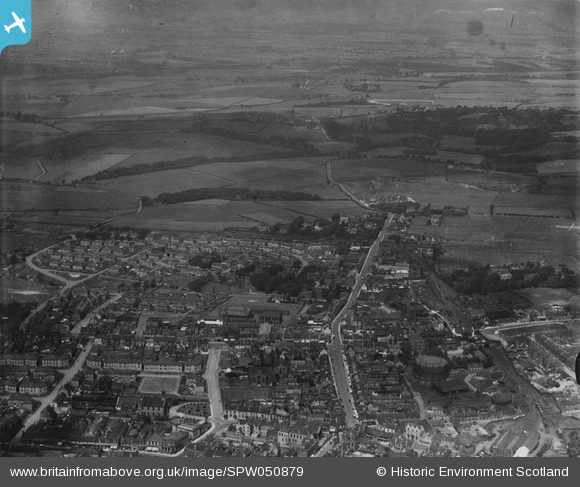
SPW050879 SCOTLAND (1936). Airdrie, general view, showing High Street and Commonside Street. An oblique aerial photograph taken facing north. This image has been produced from a print.
© Copyright OpenStreetMap contributors and licensed by the OpenStreetMap Foundation. 2024. Cartography is licensed as CC BY-SA.
Details
| Title | [SPW050879] Airdrie, general view, showing High Street and Commonside Street. An oblique aerial photograph taken facing north. This image has been produced from a print. |
| Reference | SPW050879 |
| Date | 1936 |
| Link | Canmore Collection item 1315587 |
| Place name | |
| Parish | NEW MONKLAND (MONKLANDS) |
| District | MONKLANDS |
| Country | SCOTLAND |
| Easting / Northing | 275728, 666230 |
| Longitude / Latitude | -3.9864089190792, 55.873215028491 |
| National Grid Reference | NS757662 |
Pins
 JohnDGow |
Monday 15th of April 2019 01:24:55 PM | |
jaypea |
Thursday 21st of January 2016 08:18:48 PM | |
jaypea |
Thursday 21st of January 2016 08:17:48 PM | |
jaypea |
Thursday 21st of January 2016 08:13:28 PM | |
Jim Howie |
Tuesday 30th of September 2014 12:54:34 PM |


