
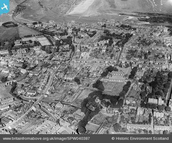
SPW040387 SCOTLAND (1932). St Andrews, general view, showing Madras College and City Road. An oblique aerial photograph taken facing north.
© Copyright OpenStreetMap contributors and licensed by the OpenStreetMap Foundation. 2024. Cartography is licensed as CC BY-SA.
Nearby Images (5)
SPW040387

SAW009808

SPW040388

SAW009812

SAW032131

Details
| Title | [SPW040387] St Andrews, general view, showing Madras College and City Road. An oblique aerial photograph taken facing north. |
| Reference | SPW040387 |
| Date | 1932 |
| Link | Canmore Collection item 1257454 |
| Place name | |
| Parish | ST ANDREWS AND ST LEONARDS |
| District | NORTH EAST FIFE |
| Country | SCOTLAND |
| Easting / Northing | 350663, 716543 |
| Longitude / Latitude | -2.7981473093929, 56.338763262737 |
| National Grid Reference | NO507165 |
Pins
 Andy A |
Tuesday 7th of January 2014 11:44:43 AM | |
Andy A |
Tuesday 7th of January 2014 11:44:25 AM |


