
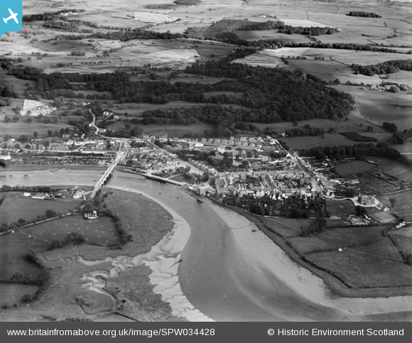
SPW034428 SCOTLAND (1930). Kirkcudbright, general view, showing Kirkcudbright Bridge and Parish Church, St Mary Street. An oblique aerial photograph taken facing south-east.
© Copyright OpenStreetMap contributors and licensed by the OpenStreetMap Foundation. 2024. Cartography is licensed as CC BY-SA.
Nearby Images (7)
SPW034428

SPW034424

SPW034426

SPW034427

SAW011714

SPW034425

SPW034423

Details
| Title | [SPW034428] Kirkcudbright, general view, showing Kirkcudbright Bridge and Parish Church, St Mary Street. An oblique aerial photograph taken facing south-east. |
| Reference | SPW034428 |
| Date | 1930 |
| Link | Canmore Collection item 1257156 |
| Place name | |
| Parish | KIRKCUDBRIGHT |
| District | STEWARTRY |
| Country | SCOTLAND |
| Easting / Northing | 268386, 550980 |
| Longitude / Latitude | -4.0494875281598, 54.836229791189 |
| National Grid Reference | NX684510 |
Pins
Be the first to add a comment to this image!


