
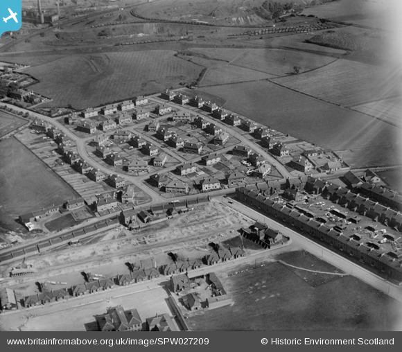
SPW027209 SCOTLAND (1929). Coatbridge, general view, showing Calder Avenue and Whifflet Street. An oblique aerial photograph taken facing south-east.
© Copyright OpenStreetMap contributors and licensed by the OpenStreetMap Foundation. 2024. Cartography is licensed as CC BY-SA.
Details
| Title | [SPW027209] Coatbridge, general view, showing Calder Avenue and Whifflet Street. An oblique aerial photograph taken facing south-east. |
| Reference | SPW027209 |
| Date | 1929 |
| Link | Canmore Collection item 1256783 |
| Place name | |
| Parish | OLD MONKLAND (MONKLANDS) |
| District | MONKLANDS |
| Country | SCOTLAND |
| Easting / Northing | 273597, 663704 |
| Longitude / Latitude | -4.0192705668323, 55.849976473769 |
| National Grid Reference | NS736637 |
Pins
 Paul Reilly |
Sunday 25th of July 2021 10:51:22 PM | |
Paul Reilly |
Sunday 25th of July 2021 10:50:04 PM | |
 |
Jamesie |
Tuesday 29th of September 2020 03:46:20 PM |
jaypea |
Saturday 23rd of July 2016 08:49:01 PM | |
L McInnes |
Sunday 17th of January 2016 01:26:21 PM | |
jaypea |
Friday 15th of January 2016 04:27:45 PM | |
jaypea |
Wednesday 13th of January 2016 07:04:27 PM | |
jaypea |
Monday 11th of January 2016 08:32:11 PM | |
jaypea |
Sunday 10th of January 2016 06:24:09 PM | |
 Billy Turner |
Thursday 14th of May 2015 07:38:17 PM | |
Billy Turner |
Thursday 14th of May 2015 01:46:06 PM | |
Billy Turner |
Thursday 14th of May 2015 01:43:10 PM | |
Billy Turner |
Thursday 14th of May 2015 01:42:03 PM | |
abc123 |
Sunday 21st of September 2014 04:08:39 PM | |
IBrown |
Saturday 20th of September 2014 06:29:44 PM |


