
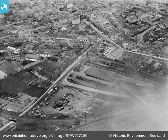
SPW027150 SCOTLAND (1929). Bathgate, general view, showing Upper Station and Whitburn Road. An oblique aerial photograph taken facing north.
© Copyright OpenStreetMap contributors and licensed by the OpenStreetMap Foundation. 2024. Cartography is licensed as CC BY-SA.
Nearby Images (6)
SPW027150

SPW027153

SPW027148

SPW027145

SPW027147

SPW027151

Details
| Title | [SPW027150] Bathgate, general view, showing Upper Station and Whitburn Road. An oblique aerial photograph taken facing north. |
| Reference | SPW027150 |
| Date | 1929 |
| Link | Canmore Collection item 1256725 |
| Place name | |
| Parish | BATHGATE |
| District | WEST LOTHIAN |
| Country | SCOTLAND |
| Easting / Northing | 297388, 668710 |
| Longitude / Latitude | -3.6413040064455, 55.900589597978 |
| National Grid Reference | NS974687 |
Pins
Be the first to add a comment to this image!


