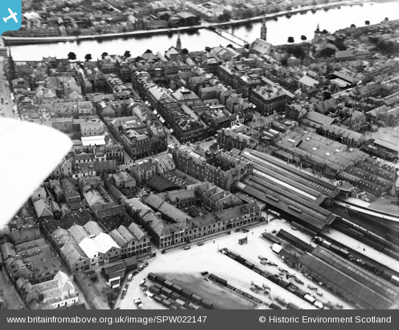
SPW022147 SCOTLAND (1928). Inverness, general view, showing Inverness Station and Academy Street. An oblique aerial photograph taken facing west.
© Copyright OpenStreetMap contributors and licensed by the OpenStreetMap Foundation. 2024. Cartography is licensed as CC BY-SA.
Nearby Images (15)
SPW022147

SPW022140

SAR016705

SAW022606

SAW022607

SPW040496

SAW022604

SAW022610

SAW022603

SAW022609

SAW022605

SAW022608

SAW022602

SPW022139

SPW040499

Details
| Title | [SPW022147] Inverness, general view, showing Inverness Station and Academy Street. An oblique aerial photograph taken facing west. |
| Reference | SPW022147 |
| Date | 1928 |
| Link | Canmore Collection item 1256516 |
| Place name | |
| Parish | INVERNESS AND BONA |
| District | INVERNESS |
| Country | SCOTLAND |
| Easting / Northing | 266782, 845430 |
| Longitude / Latitude | -4.222081643677, 57.479735159703 |
| National Grid Reference | NH668454 |
Pins
 Class31 |
Thursday 30th of October 2014 08:28:06 PM |