
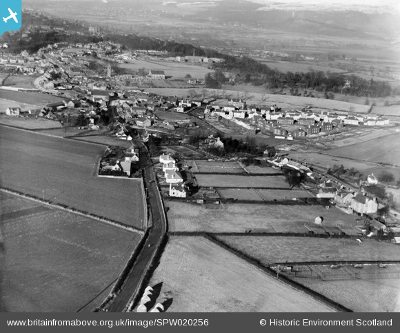
SPW020256 SCOTLAND (1928). St Ninians, general view, showing Glasgow Road and Borestone Place. An oblique aerial photograph taken facing north.
© Copyright OpenStreetMap contributors and licensed by the OpenStreetMap Foundation. 2024. Cartography is licensed as CC BY-SA.
Details
| Title | [SPW020256] St Ninians, general view, showing Glasgow Road and Borestone Place. An oblique aerial photograph taken facing north. |
| Reference | SPW020256 |
| Date | 1928 |
| Link | Canmore Collection item 1256662 |
| Place name | |
| Parish | STIRLING |
| District | STIRLING |
| Country | SCOTLAND |
| Easting / Northing | 279554, 691352 |
| Longitude / Latitude | -3.9365396827883, 56.099798516596 |
| National Grid Reference | NS796914 |
Pins
 fred |
Friday 9th of November 2012 12:49:55 PM | |
sah |
Wednesday 18th of July 2012 04:31:35 PM | |
Xabier Cid |
Monday 9th of July 2012 12:15:39 AM | |
Xabier Cid |
Monday 9th of July 2012 12:09:10 AM |


