
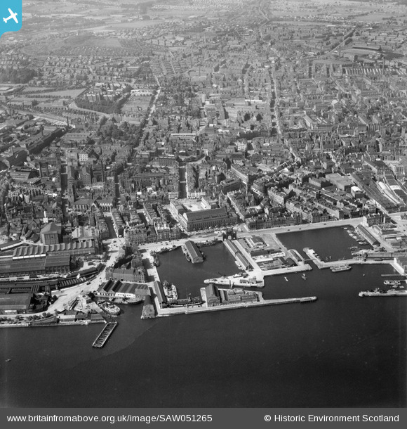
SAW051265 SCOTLAND (1953). Dundee, general view, showing King William IV Dock and Dundee Royal Infirmary. An oblique aerial photograph taken facing north.
© Copyright OpenStreetMap contributors and licensed by the OpenStreetMap Foundation. 2024. Cartography is licensed as CC BY-SA.
Nearby Images (20)
SAW051265

SPW019935

SPW019930

SAW051263

SAW009822

SPW040561

SPW042547

SPW019925

SAW019549

SAW019553

SAW014833

SAW014835

SPW060072

SAW019548

SAW019554

SPW019936

SPW019937

SPW019939

SPW060076

SPW022110

Details
| Title | [SAW051265] Dundee, general view, showing King William IV Dock and Dundee Royal Infirmary. An oblique aerial photograph taken facing north. |
| Reference | SAW051265 |
| Date | 1953 |
| Link | Canmore Collection item 1297926 |
| Place name | |
| Parish | DUNDEE (DUNDEE, CITY OF) |
| District | CITY OF DUNDEE |
| Country | SCOTLAND |
| Easting / Northing | 340381, 730240 |
| Longitude / Latitude | -2.9675760718174, 56.460632844131 |
| National Grid Reference | NO404302 |
Pins
Be the first to add a comment to this image!


