
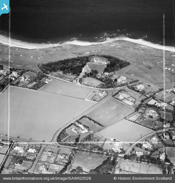
SAW022528 SCOTLAND (1949). North Berwick, general view, showing Carlekemp Priory School, Abbotsford Park and West Links. An oblique aerial photograph taken facing north. This image has been produced from a crop marked negative.
© Copyright OpenStreetMap contributors and licensed by the OpenStreetMap Foundation. 2024. Cartography is licensed as CC BY-SA.
Nearby Images (6)
SAW022528

SAR018909

SAR018910

SAW022527

SAW022529

SPW027365

Details
| Title | [SAW022528] North Berwick, general view, showing Carlekemp Priory School, Abbotsford Park and West Links. An oblique aerial photograph taken facing north. This image has been produced from a crop marked negative. |
| Reference | SAW022528 |
| Date | 1949 |
| Link | Canmore Collection item 1268961 |
| Place name | |
| Parish | DIRLETON |
| District | EAST LOTHIAN |
| Country | SCOTLAND |
| Easting / Northing | 353683, 685325 |
| Longitude / Latitude | -2.7438480979046, 56.058584070386 |
| National Grid Reference | NT537853 |
Pins
 Mike Richardson |
Monday 3rd of March 2014 11:02:57 AM | |
Mike Richardson |
Monday 3rd of March 2014 11:01:59 AM | |
Mike Richardson |
Monday 3rd of March 2014 11:01:31 AM |


