
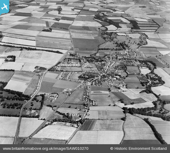
SAW010270 SCOTLAND (1947). Haddington, general view, showing West Road and Amisfield Park. An oblique aerial photograph taken facing east.
© Copyright OpenStreetMap contributors and licensed by the OpenStreetMap Foundation. 2024. Cartography is licensed as CC BY-SA.
Details
| Title | [SAW010270] Haddington, general view, showing West Road and Amisfield Park. An oblique aerial photograph taken facing east. |
| Reference | SAW010270 |
| Date | 1947 |
| Link | Canmore Collection item 1268704 |
| Place name | |
| Parish | HADDINGTON |
| District | EAST LOTHIAN |
| Country | SCOTLAND |
| Easting / Northing | 350964, 674068 |
| Longitude / Latitude | -2.7854558050275, 55.957170314908 |
| National Grid Reference | NT510741 |
Pins
 Gasometerman |
Wednesday 13th of June 2018 02:06:41 PM | |
John Wass |
Saturday 25th of April 2015 03:41:47 PM | |
Rockmanda |
Monday 9th of July 2012 10:51:11 PM |


