
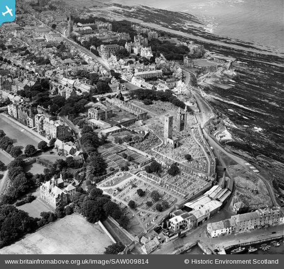
SAW009814 SCOTLAND (1947). St Andrews, general view, showing St Andrews Cathedral and St Andrews Castle. An oblique aerial photograph taken facing north-west.
© Copyright OpenStreetMap contributors and licensed by the OpenStreetMap Foundation. 2024. Cartography is licensed as CC BY-SA.
Nearby Images (9)
SAW009814

SPW020134

SAW005306

SAW024474

SPW040385

SPW020137

SAW009811

SAW005305

SPW040384

Details
| Title | [SAW009814] St Andrews, general view, showing St Andrews Cathedral and St Andrews Castle. An oblique aerial photograph taken facing north-west. |
| Reference | SAW009814 |
| Date | 1947 |
| Link | Canmore Collection item 1268657 |
| Place name | |
| Parish | ST ANDREWS AND ST LEONARDS |
| District | NORTH EAST FIFE |
| Country | SCOTLAND |
| Easting / Northing | 351420, 716620 |
| Longitude / Latitude | -2.7859165045248, 56.339533319219 |
| National Grid Reference | NO514166 |
Pins
 Henrythefifith |
Wednesday 4th of July 2012 10:07:21 AM | |
Henrythefifith |
Wednesday 4th of July 2012 10:06:26 AM |


