
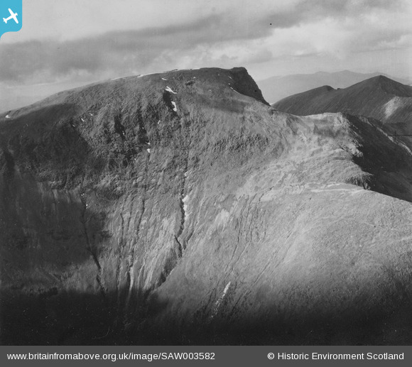
SAW003582 SCOTLAND (1947). Ben Nevis. An oblique aerial photograph taken facing north. This image has been produced from a print.
© Copyright OpenStreetMap contributors and licensed by the OpenStreetMap Foundation. 2024. Cartography is licensed as CC BY-SA.
Nearby Images (10)
SAW003582

SAR018797

SAR018798

SAR018799

SAR018800

SAR018801

SAR021131

SAW003587

SAW003588

SAW029891

Details
| Title | [SAW003582] Ben Nevis. An oblique aerial photograph taken facing north. This image has been produced from a print. |
| Reference | SAW003582 |
| Date | 1947 |
| Link | Canmore Collection item 1314688 |
| Place name | |
| Parish | KILMALLIE |
| District | LOCHABER |
| Country | SCOTLAND |
| Easting / Northing | 216652, 771254 |
| Longitude / Latitude | -5.0026771383056, 56.796775142719 |
| National Grid Reference | NN167713 |
Pins
Be the first to add a comment to this image!
User Comment Contributions
The incorrectly-numbered duplicate of this image has now been deleted. The contributions associated with it will also have been deleted. Please feel free to add your comments, pins and tags to this correct image. Yours, Jemima Britain from Above Web Admin Team |
Britain from Above |
Thursday 25th of September 2014 10:18:16 AM |
 Ben Nevis is the highest mountain in Britain, rising for more than 4,400 feet near to Fort William, in the Lochaber area of the Scottish Highlands. Its height means that it is often shrouded in mist and rain (one interpretation of the meaning of its name is 'mountain with its head in the clouds'). The high volume of precipitation creates many run-off channels for water to drain from the higher to the lower slopes and eventually to the River Nevis below. These can be seen clearly in the image, and are a good example of how erosion by the weather gradually carries material from upper to lower slopes, playing a significant role - over very long periods of time - is shaping the landscape around us. |
 AlMu |
Thursday 8th of May 2014 12:32:42 PM |


