
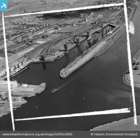
SAR014830 SCOTLAND (1951). Rothesay Dock Old Kilpatrick, Dunbartonshire, Scotland. An oblique aerial photograph taken facing East. This image was marked by AeroPictorial Ltd for photo editing.
© Copyright OpenStreetMap contributors and licensed by the OpenStreetMap Foundation. 2024. Cartography is licensed as CC BY-SA.
Nearby Images (6)
SAR014830

SAR031992

SPW022189

SPW022190

SPW022191

SPW022193

Details
| Title | [SAR014830] Rothesay Dock Old Kilpatrick, Dunbartonshire, Scotland. An oblique aerial photograph taken facing East. This image was marked by AeroPictorial Ltd for photo editing. |
| Reference | SAR014830 |
| Date | 1951 |
| Link | Canmore Collection item 1437908 |
| Place name | |
| Parish | MARITIME - GLASGOW, CITY OF |
| District | MARITIME |
| Country | SCOTLAND |
| Easting / Northing | 250100, 669100 |
| Longitude / Latitude | -4.3972762968785, 55.891694037971 |
| National Grid Reference | NS501691 |
Pins
 Gerry_R |
Friday 7th of August 2020 08:27:00 AM | |
Gerry_R |
Friday 11th of March 2016 10:54:24 AM | |
 Dylan Moore |
Wednesday 12th of August 2015 09:52:16 PM |


