
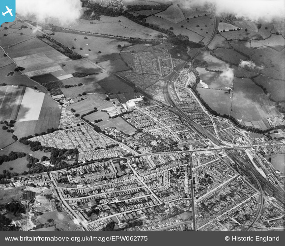
EPW062775 ENGLAND (1939). Meadow Lawn, Tonbridge, from the south-east, 1939
© Copyright OpenStreetMap contributors and licensed by the OpenStreetMap Foundation. 2024. Cartography is licensed as CC BY-SA.
Nearby Images (4)
EPW062775

EPW060386

EPW001424

EPW062776

Details
| Title | [EPW062775] Meadow Lawn, Tonbridge, from the south-east, 1939 |
| Reference | EPW062775 |
| Date | 26-August-1939 |
| Link | |
| Place name | TONBRIDGE |
| Parish | |
| District | |
| Country | ENGLAND |
| Easting / Northing | 558682, 145743 |
| Longitude / Latitude | 0.27095612351987, 51.188333912723 |
| National Grid Reference | TQ587457 |
Pins
 ladyceecee |
Friday 12th of January 2018 10:04:44 PM | |
John Wass |
Tuesday 1st of December 2015 03:20:24 PM | |
John Wass |
Tuesday 1st of December 2015 03:19:23 PM | |
John Wass |
Tuesday 1st of December 2015 03:17:55 PM | |
John Wass |
Tuesday 1st of December 2015 03:17:18 PM |


