
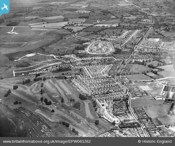
EPW061262 ENGLAND (1939). New housing estates at Oxley and Oxley Park Golf Club, Wolverhampton, 1939
© Copyright OpenStreetMap contributors and licensed by the OpenStreetMap Foundation. 2024. Cartography is licensed as CC BY-SA.
Nearby Images (2)
EPW061262

EPW017847

Details
| Title | [EPW061262] New housing estates at Oxley and Oxley Park Golf Club, Wolverhampton, 1939 |
| Reference | EPW061262 |
| Date | 31-May-1939 |
| Link | |
| Place name | WOLVERHAMPTON |
| Parish | |
| District | |
| Country | ENGLAND |
| Easting / Northing | 390939, 301921 |
| Longitude / Latitude | -2.1338407799223, 52.614633040655 |
| National Grid Reference | SJ909019 |
Pins
 EnKayJay |
Monday 7th of February 2022 02:20:47 PM | |
Darren Legh |
Monday 12th of April 2021 09:27:04 PM | |
Darren Legh |
Monday 12th of April 2021 09:22:39 PM | |
Darren Legh |
Monday 12th of April 2021 09:18:10 PM | |
Darren Legh |
Monday 12th of April 2021 09:16:47 PM | |
Darren Legh |
Monday 12th of April 2021 09:13:50 PM | |
KevTheBusDriver |
Saturday 23rd of July 2016 09:33:19 PM | |
chubbsta |
Friday 17th of April 2015 02:19:10 PM | |
Elston |
Tuesday 4th of November 2014 12:46:57 PM | |
Elston |
Monday 4th of November 2013 02:43:50 PM |


