
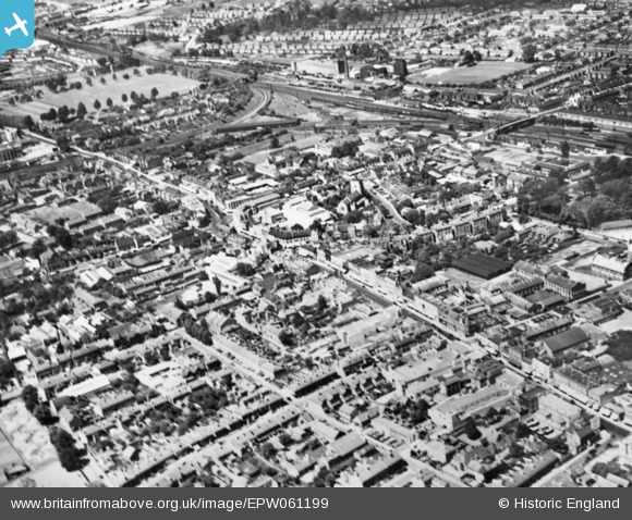
EPW061199 ENGLAND (1939). The High Street and environs, Slough, 1939. This image has been produced from a copy-negative.
© Copyright OpenStreetMap contributors and licensed by the OpenStreetMap Foundation. 2024. Cartography is licensed as CC BY-SA.
Nearby Images (22)
EPW061199

EPW061201

EPW061091

EAW030167

EPW056580

EPW012477

EPW056578

EPR000464

EAW029472

EPW056577

EPW061200

EPW012475

EAW029473

EPW061092

EPR000475

EPW061198

EPW021898

EAW042300

EAW042301

EAW042302

EPW021899

EPW056579

Details
| Title | [EPW061199] The High Street and environs, Slough, 1939. This image has been produced from a copy-negative. |
| Reference | EPW061199 |
| Date | 30-May-1939 |
| Link | |
| Place name | SLOUGH |
| Parish | |
| District | |
| Country | ENGLAND |
| Easting / Northing | 497711, 179862 |
| Longitude / Latitude | -0.59188246334604, 51.508746300451 |
| National Grid Reference | SU977799 |
Pins
 dave43 |
Friday 2nd of January 2015 09:57:40 PM |


