
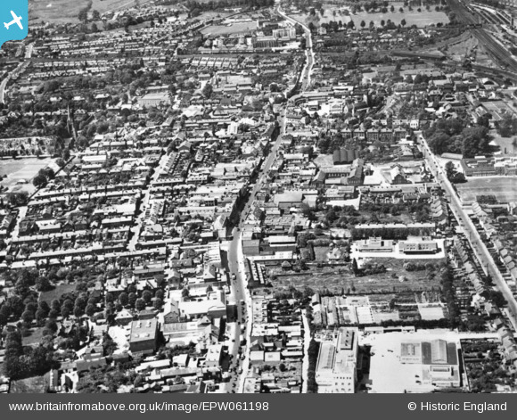
EPW061198 ENGLAND (1939). The High Street and environs, Slough, 1939. This image has been produced from a copy-negative.
© Copyright OpenStreetMap contributors and licensed by the OpenStreetMap Foundation. 2024. Cartography is licensed as CC BY-SA.
Nearby Images (7)
EPW061198

EAW029473

EPW056577

EPW056579

EPW061201

EAW042302

EPW061199

Details
| Title | [EPW061198] The High Street and environs, Slough, 1939. This image has been produced from a copy-negative. |
| Reference | EPW061198 |
| Date | 30-May-1939 |
| Link | |
| Place name | SLOUGH |
| Parish | |
| District | |
| Country | ENGLAND |
| Easting / Northing | 497929, 179751 |
| Longitude / Latitude | -0.58877271392322, 51.507710688961 |
| National Grid Reference | SU979798 |
Pins
 Mike Holder |
Monday 15th of February 2016 10:05:57 PM | |
Mike Holder |
Monday 15th of February 2016 10:04:11 PM | |
Mike Holder |
Monday 15th of February 2016 09:57:34 PM | |
Mike Holder |
Monday 15th of February 2016 09:52:27 PM | |
Mike Holder |
Monday 15th of February 2016 09:50:49 PM | |
Mike Holder |
Monday 15th of February 2016 09:49:24 PM | |
Mike Holder |
Monday 15th of February 2016 09:45:17 PM | |
dave43 |
Friday 2nd of January 2015 09:56:44 PM |


