
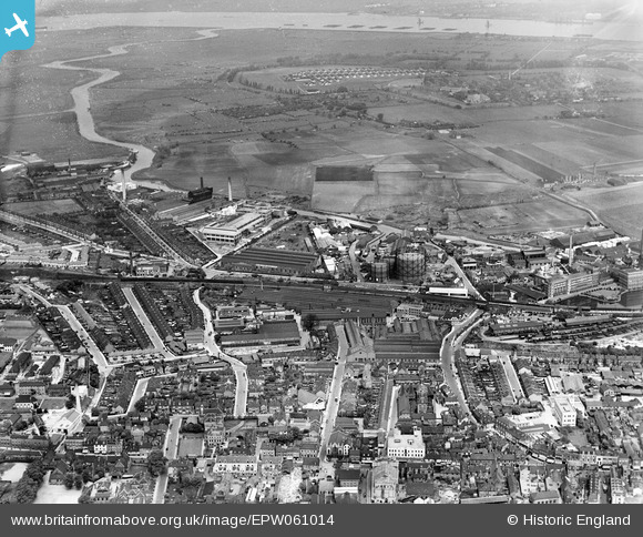
EPW061014 ENGLAND (1939). The town centre and Dartford Fresh Marshes, Dartford, from the south, 1939
© Copyright OpenStreetMap contributors and licensed by the OpenStreetMap Foundation. 2024. Cartography is licensed as CC BY-SA.
Nearby Images (16)
EPW061014

EPW021976

EPW021977

EPW061007

EPW061012

EPW021980

EPW021982

EPW021978

EPW021979

EPW061008

EPW010895

EPW057058

EPW057059

EPW061011

EPW028231

EAW048627

Details
| Title | [EPW061014] The town centre and Dartford Fresh Marshes, Dartford, from the south, 1939 |
| Reference | EPW061014 |
| Date | 22-May-1939 |
| Link | |
| Place name | DARTFORD |
| Parish | |
| District | |
| Country | ENGLAND |
| Easting / Northing | 554003, 174309 |
| Longitude / Latitude | 0.21638890677297, 51.446310668684 |
| National Grid Reference | TQ540743 |
Pins
 Chiltern View |
Saturday 13th of August 2016 12:47:36 PM | |
 Dylan Moore |
Thursday 22nd of August 2013 07:33:46 PM |


