
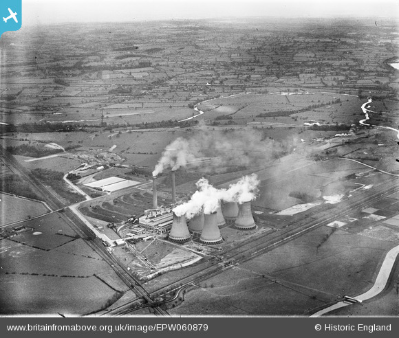
EPW060879 ENGLAND (1939). Hams Hall Power Station, Curdworth, from the south-west, 1939
© Copyright OpenStreetMap contributors and licensed by the OpenStreetMap Foundation. 2024. Cartography is licensed as CC BY-SA.
Nearby Images (24)
EPW060879

EPW023692

EPW023684

EPW023685

EPW023681

EPW023687

EPW023683

EPW023682

EPW023691

EPW023686

EPW060886

EPW023688

EPW060885

EPW023680

EAW021642

EPW023690

EPW060884

EAW021640

EAW021639

EPW060883

EAW021641

EPW060880

EPW023694

EPW060877

Details
| Title | [EPW060879] Hams Hall Power Station, Curdworth, from the south-west, 1939 |
| Reference | EPW060879 |
| Date | April-1939 |
| Link | |
| Place name | CURDWORTH |
| Parish | CURDWORTH |
| District | |
| Country | ENGLAND |
| Easting / Northing | 419294, 291870 |
| Longitude / Latitude | -1.715593424057, 52.523999714522 |
| National Grid Reference | SP193919 |
Pins
Be the first to add a comment to this image!


