
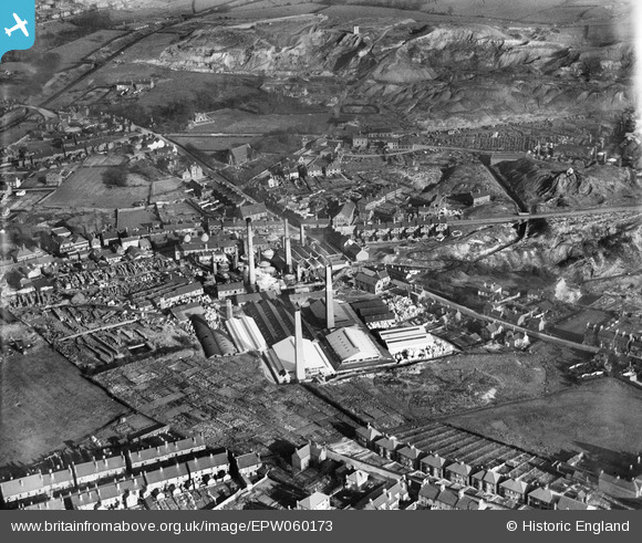
EPW060173 ENGLAND (1938). The Anchor Brick and Pipe Works, Swadlincote, 1938
© Copyright OpenStreetMap contributors and licensed by the OpenStreetMap Foundation. 2024. Cartography is licensed as CC BY-SA.
Nearby Images (14)
EPW060173

EPW060170

EPW060171

EPW015197

EPW060172

EPW015190

EPW015198

EPW015192

EPW060168

EPW015193

EPW015191

EPW015194

EPW015195

EPW060169

Details
| Title | [EPW060173] The Anchor Brick and Pipe Works, Swadlincote, 1938 |
| Reference | EPW060173 |
| Date | November-1938 |
| Link | |
| Place name | SWADLINCOTE |
| Parish | |
| District | |
| Country | ENGLAND |
| Easting / Northing | 430169, 319437 |
| Longitude / Latitude | -1.5527715858727, 52.771346565209 |
| National Grid Reference | SK302194 |
Pins
Be the first to add a comment to this image!


