
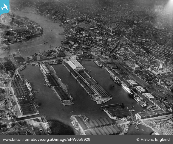
EPW059929 ENGLAND (1938). West India Docks and environs, Canary Wharf, 1938
© Copyright OpenStreetMap contributors and licensed by the OpenStreetMap Foundation. 2024. Cartography is licensed as CC BY-SA.
Nearby Images (8)
EPW059929

EPW044129

EPW044127

EPW005993
, Canary Wharf, 1921")
EPW045543

EPW059926

EPW024258

EPW059930

Details
| Title | [EPW059929] West India Docks and environs, Canary Wharf, 1938 |
| Reference | EPW059929 |
| Date | 15-October-1938 |
| Link | |
| Place name | CANARY WHARF |
| Parish | |
| District | |
| Country | ENGLAND |
| Easting / Northing | 537383, 180385 |
| Longitude / Latitude | -0.020277839415223, 51.505193380216 |
| National Grid Reference | TQ374804 |
Pins
 Chaz |
Sunday 21st of January 2024 04:11:13 PM | |
 Class31 |
Saturday 15th of November 2014 09:06:01 AM | |
Class31 |
Saturday 15th of November 2014 09:03:30 AM |


User Comment Contributions
 St. Anne's Church, Limehouse, Commercial Road, 30/09/2014 |
Class31 |
Saturday 15th of November 2014 09:04:22 AM |


