
EPW059853 ENGLAND (1938). Carbis Bay, St Ives, from the north-east, 1938

© Copyright OpenStreetMap contributors and licensed by the OpenStreetMap Foundation. 2024. Cartography is licensed as CC BY-SA.
Nearby Images (3)
EPW059853

EPW021750

EPW039845

Details
| Title | [EPW059853] Carbis Bay, St Ives, from the north-east, 1938 |
| Reference | EPW059853 |
| Date | 22-September-1938 |
| Link | |
| Place name | ST IVES |
| Parish | ST. IVES |
| District | |
| Country | ENGLAND |
| Easting / Northing | 152783, 38894 |
| Longitude / Latitude | -5.4644583154645, 50.197732636088 |
| National Grid Reference | SW528389 |
Pins


User Comment Contributions
Shoreline SeaSpray and Beachside 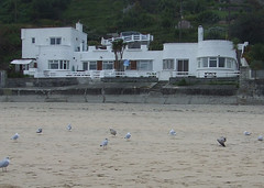 |
 longshot |
Monday 17th of June 2013 07:46:15 PM |


