
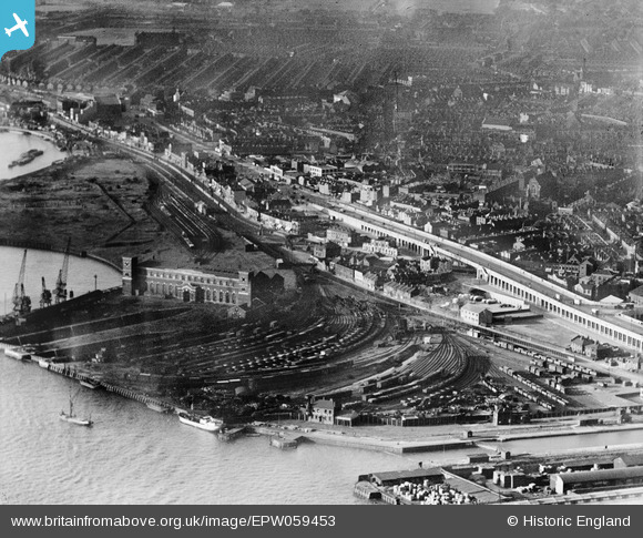
EPW059453 ENGLAND (1938). The Thames Wharf and environs, Canning Town, 1938
© Copyright OpenStreetMap contributors and licensed by the OpenStreetMap Foundation. 2024. Cartography is licensed as CC BY-SA.
Nearby Images (6)
EPW059453

EPW040853

EPW040854

EPW059455

EPW059407

EPW046798

Details
| Title | [EPW059453] The Thames Wharf and environs, Canning Town, 1938 |
| Reference | EPW059453 |
| Date | 15-September-1938 |
| Link | |
| Place name | CANNING TOWN |
| Parish | |
| District | |
| Country | ENGLAND |
| Easting / Northing | 539724, 180826 |
| Longitude / Latitude | 0.013609074399333, 51.508582593921 |
| National Grid Reference | TQ397808 |
Pins
 sarahearney |
Sunday 28th of July 2013 05:05:15 PM |


