
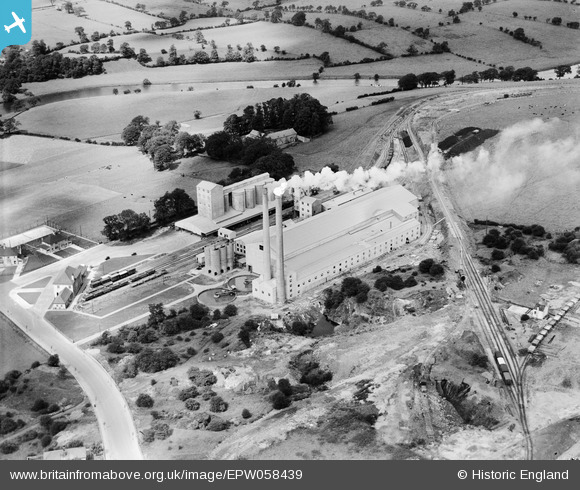
EPW058439 ENGLAND (1938). Ribble Cement Works, Horrocksford, 1938
© Copyright OpenStreetMap contributors and licensed by the OpenStreetMap Foundation. 2024. Cartography is licensed as CC BY-SA.
Nearby Images (6)
EPW058439

EPW058440

EPW058441

EPW058438

EPW058437

EPW058442

Details
| Title | [EPW058439] Ribble Cement Works, Horrocksford, 1938 |
| Reference | EPW058439 |
| Date | 26-July-1938 |
| Link | |
| Place name | HORROCKSFORD |
| Parish | CLITHEROE |
| District | |
| Country | ENGLAND |
| Easting / Northing | 374814, 443695 |
| Longitude / Latitude | -2.3832441226942, 53.888622119662 |
| National Grid Reference | SD748437 |
Pins
 Dylan Moore |
Saturday 15th of June 2013 12:21:09 PM | |
Dylan Moore |
Saturday 15th of June 2013 12:20:44 PM | |
Dylan Moore |
Saturday 15th of June 2013 12:20:08 PM | |
Dylan Moore |
Saturday 15th of June 2013 12:19:52 PM | |
Dylan Moore |
Saturday 15th of June 2013 12:19:32 PM | |
Dylan Moore |
Saturday 15th of June 2013 12:19:06 PM | |
Dylan Moore |
Saturday 15th of June 2013 12:18:46 PM | |
Dylan Moore |
Saturday 15th of June 2013 12:18:24 PM | |
Dylan Moore |
Saturday 15th of June 2013 12:17:43 PM | |
Dylan Moore |
Saturday 15th of June 2013 12:17:29 PM | |
Dylan Moore |
Saturday 15th of June 2013 12:17:05 PM |


