
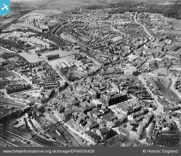
EPW058428 ENGLAND (1938). The town centre, Wigan, from the south, 1938
© Copyright OpenStreetMap contributors and licensed by the OpenStreetMap Foundation. 2024. Cartography is licensed as CC BY-SA.
Nearby Images (5)
EPW058428

EPW058426

EPW005026

EPW005028

EPW005024

Details
| Title | [EPW058428] The town centre, Wigan, from the south, 1938 |
| Reference | EPW058428 |
| Date | 26-July-1938 |
| Link | |
| Place name | WIGAN |
| Parish | |
| District | |
| Country | ENGLAND |
| Easting / Northing | 358302, 405488 |
| Longitude / Latitude | -2.6293388803838, 53.544130152099 |
| National Grid Reference | SD583055 |
Pins
 Eduardo |
Tuesday 29th of October 2019 10:18:49 AM | |
Eduardo |
Friday 2nd of March 2018 01:53:44 PM | |
Eddie |
Wednesday 2nd of December 2015 01:52:59 PM | |
gBr |
Wednesday 6th of August 2014 12:36:23 AM | |
Eddie |
Friday 6th of June 2014 04:09:16 PM | |
Arrrnete |
Sunday 25th of May 2014 01:27:55 PM | |
Joe |
Sunday 1st of September 2013 09:37:17 PM | |
Joe |
Sunday 1st of September 2013 09:35:24 PM |


