
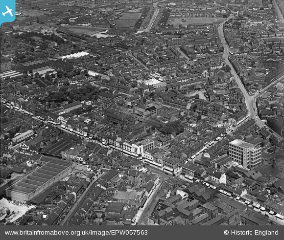
EPW057563 ENGLAND (1938). The High Street and town around Hudson's Soap Works, West Bromwich, 1938
© Copyright OpenStreetMap contributors and licensed by the OpenStreetMap Foundation. 2024. Cartography is licensed as CC BY-SA.
Nearby Images (12)
EPW057563

EPW021861

EPW057564

EPW021862

EPW042923

EPW042925

EPW042927

EPW042924

EPW042930

EPW042922

EPW042926

EPW042921

Details
| Title | [EPW057563] The High Street and town around Hudson's Soap Works, West Bromwich, 1938 |
| Reference | EPW057563 |
| Date | 14-June-1938 |
| Link | |
| Place name | WEST BROMWICH |
| Parish | |
| District | |
| Country | ENGLAND |
| Easting / Northing | 400702, 291149 |
| Longitude / Latitude | -1.9896535002715, 52.517858472947 |
| National Grid Reference | SP007911 |
Pins
 Rob |
Friday 26th of August 2022 01:04:36 PM | |
Rob |
Friday 26th of August 2022 01:03:59 PM | |
Mikeya |
Wednesday 12th of June 2019 05:44:48 PM | |
Mikeya |
Wednesday 12th of June 2019 05:42:09 PM | |
Mikeya |
Wednesday 12th of June 2019 05:40:41 PM | |
Mikeya |
Wednesday 12th of June 2019 05:16:17 PM | |
Mikeya |
Wednesday 12th of June 2019 05:13:03 PM | |
DaveT |
Saturday 19th of April 2014 08:20:02 PM | |
DaveT |
Saturday 19th of April 2014 07:21:58 PM | |
DaveT |
Saturday 19th of April 2014 07:08:54 PM | |
DaveT |
Saturday 19th of April 2014 07:06:53 PM | |
DaveT |
Saturday 19th of April 2014 06:47:57 PM |


