
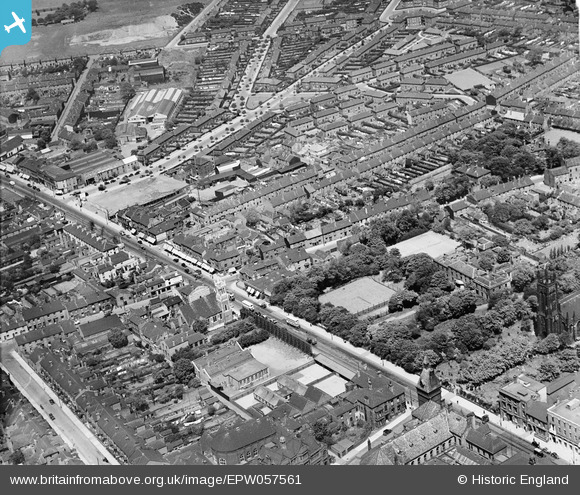
EPW057561 ENGLAND (1938). The High Street at Kenrick Technical College and Highfields, West Bromwich, 1938
© Copyright OpenStreetMap contributors and licensed by the OpenStreetMap Foundation. 2024. Cartography is licensed as CC BY-SA.
Nearby Images (3)
EPW057561

EPW053146

EPW001112

Details
| Title | [EPW057561] The High Street at Kenrick Technical College and Highfields, West Bromwich, 1938 |
| Reference | EPW057561 |
| Date | 14-June-1938 |
| Link | |
| Place name | WEST BROMWICH |
| Parish | |
| District | |
| Country | ENGLAND |
| Easting / Northing | 400139, 291617 |
| Longitude / Latitude | -1.997951138344, 52.522066670532 |
| National Grid Reference | SP001916 |
Pins
 fkistler |
Saturday 10th of October 2015 07:38:30 PM | |
fkistler |
Saturday 10th of October 2015 07:37:51 PM | |
DaveT |
Saturday 5th of April 2014 02:25:13 PM | |
DaveT |
Saturday 5th of April 2014 02:25:12 PM | |
DaveT |
Saturday 5th of April 2014 02:15:03 PM | |
DaveT |
Saturday 5th of April 2014 02:15:00 PM | |
DaveT |
Saturday 5th of April 2014 02:14:58 PM |


