
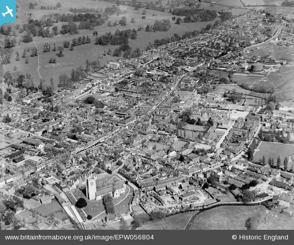
EPW056804 ENGLAND (1938). St Andrew's Church and the town, Farnham, 1938
© Copyright OpenStreetMap contributors and licensed by the OpenStreetMap Foundation. 2024. Cartography is licensed as CC BY-SA.
Nearby Images (6)
EPW056804

EPW022727

EPW022735

EPW056806

EPW056807

EPW032697

Details
| Title | [EPW056804] St Andrew's Church and the town, Farnham, 1938 |
| Reference | EPW056804 |
| Date | 10-April-1938 |
| Link | |
| Place name | FARNHAM |
| Parish | FARNHAM |
| District | |
| Country | ENGLAND |
| Easting / Northing | 484040, 146910 |
| Longitude / Latitude | -0.79663480149749, 51.214683353304 |
| National Grid Reference | SU840469 |
Pins
 Sweet Pete |
Saturday 14th of November 2015 03:01:09 PM | |
Sweet Pete |
Saturday 14th of November 2015 02:59:44 PM | |
Sweet Pete |
Saturday 14th of November 2015 02:58:55 PM |
User Comment Contributions
You only need to view this photograph to understand the extent to which Farnham has been raped by careless planners. |
Sweet Pete |
Saturday 14th of November 2015 03:04:48 PM |
All appear quiet and peaceful. Very few people or vehicles about even though a number of shops have their sunblind awnings out. The 10th April 1938 was, in fact, a Sunday. |
flubber |
Sunday 12th of October 2014 12:51:32 AM |


