
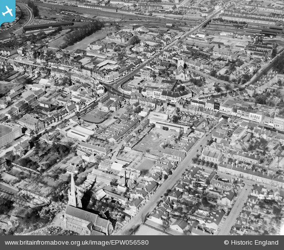
EPW056580 ENGLAND (1938). The Market Hall and the town centre, Slough, 1938
© Copyright OpenStreetMap contributors and licensed by the OpenStreetMap Foundation. 2024. Cartography is licensed as CC BY-SA.
Nearby Images (17)
EPW056580

EPW012477

EAW029472

EAW030167

EPW056578

EPW061199

EPW061091

EPR000464

EPW061201

EPW061200

EPW012475

EPR000475

EPW056577

EPW056576

EPW061092

EPW012476A

EPW056579

Details
| Title | [EPW056580] The Market Hall and the town centre, Slough, 1938 |
| Reference | EPW056580 |
| Date | March-1938 |
| Link | |
| Place name | SLOUGH |
| Parish | |
| District | |
| Country | ENGLAND |
| Easting / Northing | 497631, 179799 |
| Longitude / Latitude | -0.59305242032511, 51.508193775572 |
| National Grid Reference | SU976798 |
Pins
 Tony S |
Monday 1st of September 2014 04:17:40 PM | |
dave43 |
Saturday 17th of August 2013 10:23:22 PM | |
dave43 |
Saturday 17th of August 2013 10:22:23 PM | |
dave43 |
Saturday 17th of August 2013 10:21:42 PM | |
payitforwardeddie |
Wednesday 12th of June 2013 11:21:47 PM |


