
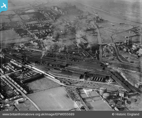
EPW055689 ENGLAND (1937). The Wolverhampton Corrugated Iron Co Mersey Works, Ellesmere Port, 1937
© Copyright OpenStreetMap contributors and licensed by the OpenStreetMap Foundation. 2024. Cartography is licensed as CC BY-SA.
Nearby Images (17)
EPW055689

EPW014968

EPW055696

EPW055692

EPW055695

EPW055693

EPW055697

EPW014969

EPW055690

EPW014963

EPW055691

EPW014964

EPW014966

EPW055694

EPW014970

EPW014965

EPW014967

Details
| Title | [EPW055689] The Wolverhampton Corrugated Iron Co Mersey Works, Ellesmere Port, 1937 |
| Reference | EPW055689 |
| Date | 30-September-1937 |
| Link | |
| Place name | ELLESMERE PORT |
| Parish | |
| District | |
| Country | ENGLAND |
| Easting / Northing | 340660, 376472 |
| Longitude / Latitude | -2.8901130366232, 53.281622392188 |
| National Grid Reference | SJ407765 |
Pins
 Class31 |
Sunday 2nd of August 2015 07:41:59 PM | |
 Dylan Moore |
Sunday 14th of June 2015 02:16:18 PM | |
Dylan Moore |
Sunday 14th of June 2015 02:15:39 PM | |
Dylan Moore |
Sunday 14th of June 2015 02:14:48 PM | |
Dylan Moore |
Sunday 14th of June 2015 02:13:07 PM | |
 Rob |
Thursday 12th of September 2013 01:26:50 PM |


