
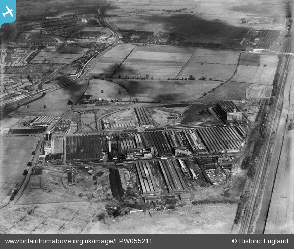
EPW055211 ENGLAND (1937). The Fort Dunlop Rubber Works, Bromford, 1937
© Copyright OpenStreetMap contributors and licensed by the OpenStreetMap Foundation. 2024. Cartography is licensed as CC BY-SA.
Nearby Images (17)
EPW055211

EPW055210

EPW055216

EPW055214

EPW055213

EPW026939

EPW026937

EPW055218

EPW025791

EPW055217

EPW026932

EPW022583

EPW026942

EPW055215

EPW022582

EPW018353

EPW055212

Details
| Title | [EPW055211] The Fort Dunlop Rubber Works, Bromford, 1937 |
| Reference | EPW055211 |
| Date | 4-September-1937 |
| Link | |
| Place name | BROMFORD |
| Parish | |
| District | |
| Country | ENGLAND |
| Easting / Northing | 412745, 290486 |
| Longitude / Latitude | -1.8121824616777, 52.511748895297 |
| National Grid Reference | SP127905 |
Pins
 Paul Reynolds |
Tuesday 21st of January 2014 07:33:29 PM | |
Paul Reynolds |
Tuesday 21st of January 2014 07:33:23 PM |


