
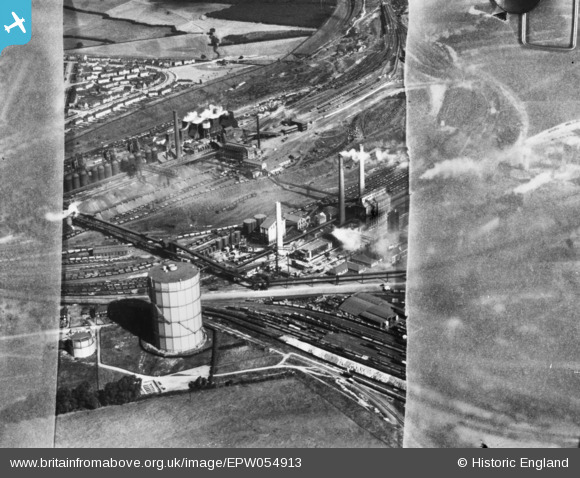
EPW054913 ENGLAND (1937). Part of the Stewarts and Lloyds Iron and Steel Works, Corby, 1937. This image has been produced from a copy-negative.
© Copyright OpenStreetMap contributors and licensed by the OpenStreetMap Foundation. 2024. Cartography is licensed as CC BY-SA.
Nearby Images (23)
EPW054913

EAW034119

EAW034116

EAW034123

EAW034117

EAW034120

EAW034113

EPW049774

EAW034115

EPW049775

EPW049771

EAW034121

EAW034114

EAW034118

EPW049772

EPW049770

EPW054923

EPW054912

EAW045576

EPW049767

EPW049765

EAW045454
, Corby, from the south-east, 1952")
EAW045453

Details
| Title | [EPW054913] Part of the Stewarts and Lloyds Iron and Steel Works, Corby, 1937. This image has been produced from a copy-negative. |
| Reference | EPW054913 |
| Date | 16-August-1937 |
| Link | |
| Place name | CORBY |
| Parish | |
| District | |
| Country | ENGLAND |
| Easting / Northing | 489865, 289454 |
| Longitude / Latitude | -0.67616551096635, 52.495213799585 |
| National Grid Reference | SP899895 |
Pins
Be the first to add a comment to this image!


