
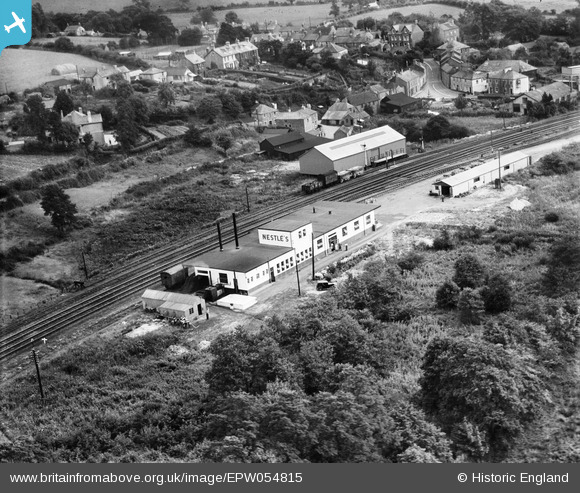
EPW054815 ENGLAND (1937). The Nestle Milk Factory, Lostwithiel, 1937
© Copyright OpenStreetMap contributors and licensed by the OpenStreetMap Foundation. 2024. Cartography is licensed as CC BY-SA.
Nearby Images (6)
EPW054815

EPW054817

EPW054814

EPW054818

EPW054816

EPW033042

Details
| Title | [EPW054815] The Nestle Milk Factory, Lostwithiel, 1937 |
| Reference | EPW054815 |
| Date | August-1937 |
| Link | |
| Place name | LOSTWITHIEL |
| Parish | LOSTWITHIEL |
| District | |
| Country | ENGLAND |
| Easting / Northing | 210716, 60005 |
| Longitude / Latitude | -4.66424606105, 50.408774524383 |
| National Grid Reference | SX107600 |
Pins
Be the first to add a comment to this image!
User Comment Contributions
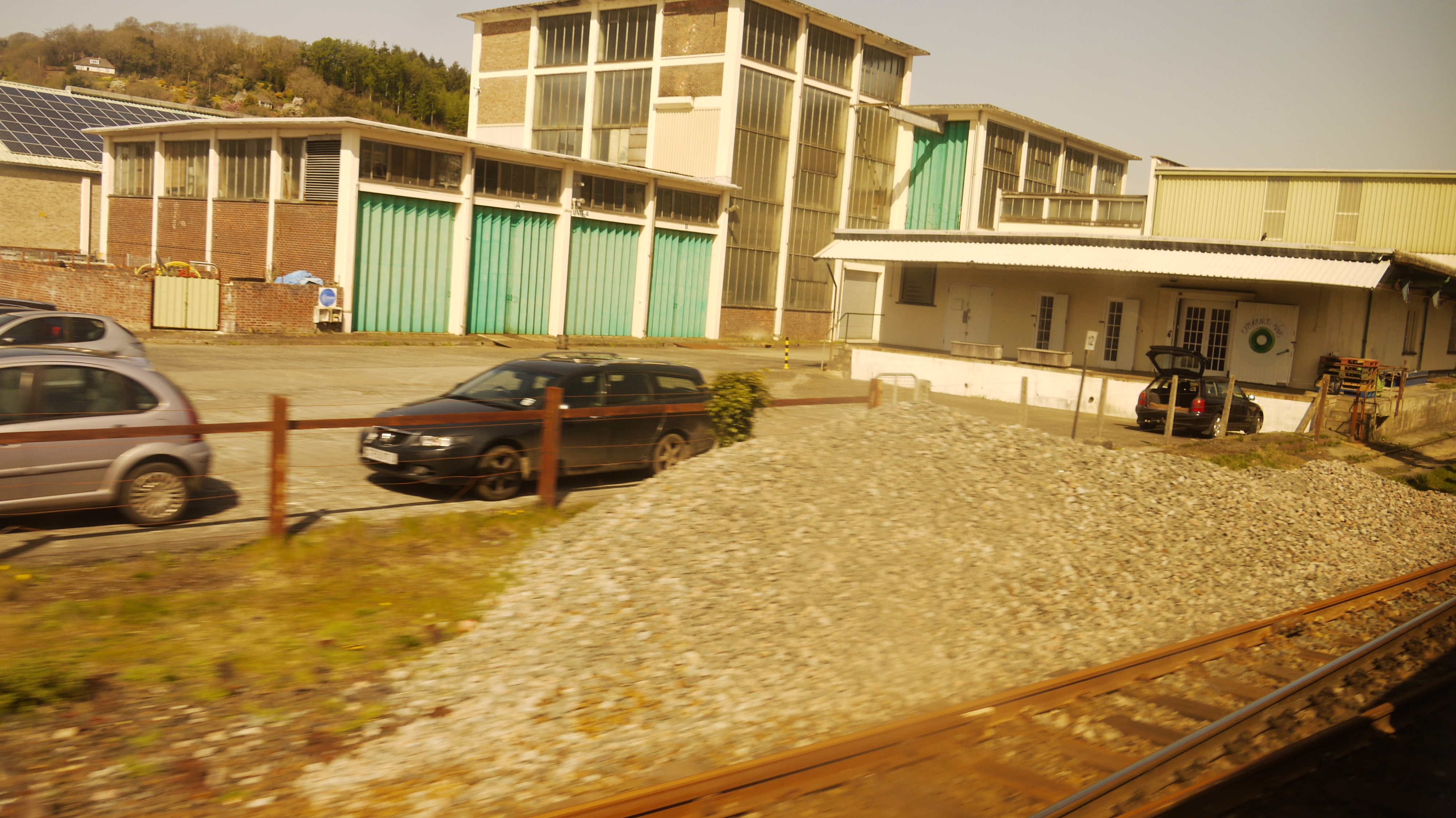 The Nestle Milk Factory, Lostwithiel, from a passing train, 15/04/2015 |
 Class31 |
Thursday 16th of April 2015 09:17:40 AM |


