
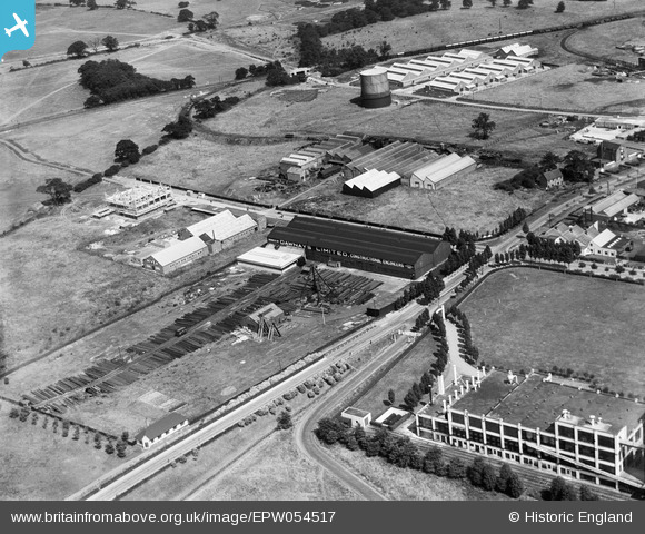
EPW054517 ENGLAND (1937). The Dawnays Limited Engineering Works and surrounding industrial units, Welwyn Garden City, 1937
© Copyright OpenStreetMap contributors and licensed by the OpenStreetMap Foundation. 2024. Cartography is licensed as CC BY-SA.
Nearby Images (26)
EPW054517

EPW054516

EPW054536

EPW022022

EAW052823

EPW054506

EAW052818

EAW052821

EAW052817

EAW052822

EAW052819

EAW052816

EAW052820

EPW054519

EAW053083

EAW053109

EPW022032

EPW054507

EPW062053

EPW054500

EPW014808

EPW014807

EPW014809

EAW053104

EPW025533

EPW047354

Details
| Title | [EPW054517] The Dawnays Limited Engineering Works and surrounding industrial units, Welwyn Garden City, 1937 |
| Reference | EPW054517 |
| Date | 30-July-1937 |
| Link | |
| Place name | WELWYN GARDEN CITY |
| Parish | |
| District | |
| Country | ENGLAND |
| Easting / Northing | 524297, 213114 |
| Longitude / Latitude | -0.19710822657778, 51.802386816263 |
| National Grid Reference | TL243131 |
Pins
Be the first to add a comment to this image!


