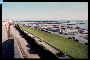
EPW054036 ENGLAND (1937). Marine Drive, Kemp Town and environs, Brighton, from the south-east, 1937
© Copyright OpenStreetMap contributors and licensed by the OpenStreetMap Foundation. 2024. Cartography is licensed as CC BY-SA.
Nearby Images (5)
Details
| Title | [EPW054036] Marine Drive, Kemp Town and environs, Brighton, from the south-east, 1937 |
| Reference | EPW054036 |
| Date | June-1937 |
| Link | |
| Place name | BRIGHTON |
| Parish | |
| District | |
| Country | ENGLAND |
| Easting / Northing | 533383, 103516 |
| Longitude / Latitude | -0.1063925456894, 50.815250198469 |
| National Grid Reference | TQ334035 |
Pins
 Class31 |
Saturday 29th of November 2014 11:42:45 AM | |
 Class31 |
Saturday 29th of November 2014 11:42:04 AM | |
 Class31 |
Saturday 29th of November 2014 11:40:47 AM | |
 Class31 |
Saturday 29th of November 2014 11:38:48 AM | |
 Alan McFaden |
Thursday 9th of January 2014 10:06:32 AM | |
 Alan McFaden |
Friday 15th of November 2013 05:32:01 PM | |
 Alan McFaden |
Friday 15th of November 2013 05:30:32 PM |
User Comment Contributions
London Road Railway Viaduct, Brighton, 02/06/2014 |
 Class31 |
Saturday 29th of November 2014 11:41:19 AM |


![[EPW054036] Marine Drive, Kemp Town and environs, Brighton, from the south-east, 1937](http://britainfromabove.org.uk/sites/all/libraries/aerofilms-images/public/100x100/EPW/054/EPW054036.jpg)
![[EAW024793] Blackrock Swimming Pool below Arundel Terrace, Brighton, 1949](http://britainfromabove.org.uk/sites/all/libraries/aerofilms-images/public/100x100/EAW/024/EAW024793.jpg)
![[EAW006610] Black Rock Lido and environs, Black Rock, 1947](http://britainfromabove.org.uk/sites/all/libraries/aerofilms-images/public/100x100/EAW/006/EAW006610.jpg)
![[EAW037807] Kemp Town, Brighton, 1951. This image has been produced from a print marked by Aerofilms Ltd for photo editing.](http://britainfromabove.org.uk/sites/all/libraries/aerofilms-images/public/100x100/EAW/037/EAW037807.jpg)
![[EPW016880] Kemp Town, Brighton, 1926](http://britainfromabove.org.uk/sites/all/libraries/aerofilms-images/public/100x100/EPW/016/EPW016880.jpg)


