
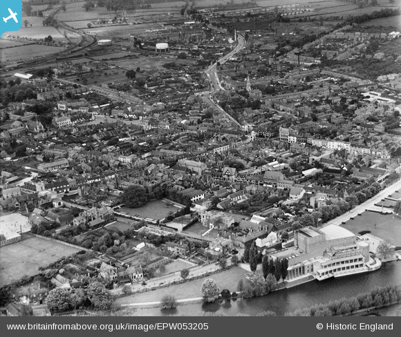
EPW053205 ENGLAND (1937). The town centre, Stratford-upon-Avon, from the south-east, 1937
© Copyright OpenStreetMap contributors and licensed by the OpenStreetMap Foundation. 2024. Cartography is licensed as CC BY-SA.
Nearby Images (33)
EPW053205

EAW013452

EAW044237

EPR000580

EPR000082
, Stratford-upon-Avon, 1934")
EAW013451

EPW014650

EPW037592

EPW026845

EAW013453

EPW037593

EPW053203

EPR000081
, Stratford-upon-Avon, 1934. This image has been produced from a damaged negative.")
EPW037594

EAW025670

EPW037591

EPW053202

EPW053206

EAW044239

EPW053207

EPW026838

EAW006663

EPW026842

EAW006662

EPW053186

EPW026839

EPW053187

EPW014647

EPW001322

EAW006661

EAW013455

EPW053209

EAW003576

Details
| Title | [EPW053205] The town centre, Stratford-upon-Avon, from the south-east, 1937 |
| Reference | EPW053205 |
| Date | 24-May-1937 |
| Link | |
| Place name | STRATFORD-UPON-AVON |
| Parish | STRATFORD-UPON-AVON |
| District | |
| Country | ENGLAND |
| Easting / Northing | 420245, 254734 |
| Longitude / Latitude | -1.7038159308875, 52.190072677718 |
| National Grid Reference | SP202547 |
Pins
Be the first to add a comment to this image!


