
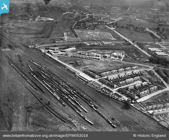
EPW053018 ENGLAND (1937). Construction of housing and industrial buildings along Beresford Avenue and environs, Alperton, 1937
© Copyright OpenStreetMap contributors and licensed by the OpenStreetMap Foundation. 2024. Cartography is licensed as CC BY-SA.
Nearby Images (29)
EPW053018

EPW051678

EPW051674

EPW053021

EPW052467

EPW051672

EPW052465

EPW056366

EPW056467

EPW056468

EPW051676

EPW056469

EPW051679

EPW053017

EPW051675

EPW056470

EPW053022

EPW051673

EPW053020

EPW051680

EPW051677

EPW053019

EPW056464

EPW056463

EPW056465

EPW056415
, Alperton, 1938")
EPW056417
, Alperton, 1938")
EPW056418
, Alperton, 1938. This image has been affected by flare.")
EPW056461

Details
| Title | [EPW053018] Construction of housing and industrial buildings along Beresford Avenue and environs, Alperton, 1937 |
| Reference | EPW053018 |
| Date | 17-May-1937 |
| Link | |
| Place name | ALPERTON |
| Parish | |
| District | |
| Country | ENGLAND |
| Easting / Northing | 519314, 183986 |
| Longitude / Latitude | -0.2793009029835, 51.54166536975 |
| National Grid Reference | TQ193840 |
Pins
 Rudgey |
Monday 3rd of October 2016 08:43:55 PM |


