
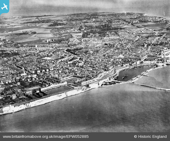
EPW052885 ENGLAND (1937). The town, Ramsgate, from the south, 1937. This image has been produced from a copy-negative.
© Copyright OpenStreetMap contributors and licensed by the OpenStreetMap Foundation. 2024. Cartography is licensed as CC BY-SA.
Nearby Images (10)
EPW052885

EPW039356

EAW006626

EAW009024

EAW696658

EPW013301

EPW000081

EAW006625

EAW020488

EPW000094

Details
| Title | [EPW052885] The town, Ramsgate, from the south, 1937. This image has been produced from a copy-negative. |
| Reference | EPW052885 |
| Date | 24-April-1937 |
| Link | |
| Place name | RAMSGATE |
| Parish | RAMSGATE |
| District | |
| Country | ENGLAND |
| Easting / Northing | 638041, 164185 |
| Longitude / Latitude | 1.4171599504835, 51.326357950867 |
| National Grid Reference | TR380642 |
Pins
 Alan McFaden |
Sunday 9th of November 2014 01:46:23 PM | |
Alan McFaden |
Sunday 9th of November 2014 01:45:44 PM | |
Alan McFaden |
Sunday 9th of November 2014 01:45:04 PM |


User Comment Contributions
 George 1V Monument Ramsgate |
Alan McFaden |
Sunday 9th of November 2014 01:47:13 PM |
 Ramsgate Beach |
Alan McFaden |
Sunday 9th of November 2014 01:46:43 PM |
 Ramsgate Harbour |
Alan McFaden |
Sunday 9th of November 2014 01:44:30 PM |


