
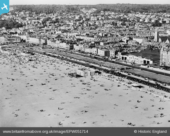
EPW051714 ENGLAND (1936). Beach Lawns and the town, Weston-super-Mare, from the south-west, 1936. This image has been produced from a copy-negative.
© Copyright OpenStreetMap contributors and licensed by the OpenStreetMap Foundation. 2024. Cartography is licensed as CC BY-SA.
Nearby Images (14)
EPW051714

EPW048444

EPW048454

EPW001033

EPW023957

EPW023961

EPW048445

EPW023956

EAW015058

EAW025149
 to Birnbeck Island, Weston-super-Mare, from the south, 1949")
EPW048458

EAW056067

EPW048455

EPW048449

Details
| Title | [EPW051714] Beach Lawns and the town, Weston-super-Mare, from the south-west, 1936. This image has been produced from a copy-negative. |
| Reference | EPW051714 |
| Date | August-1936 |
| Link | |
| Place name | WESTON-SUPER-MARE |
| Parish | WESTON-SUPER-MARE |
| District | |
| Country | ENGLAND |
| Easting / Northing | 331677, 161006 |
| Longitude / Latitude | -2.9810497524122, 51.343525505851 |
| National Grid Reference | ST317610 |
Pins
Be the first to add a comment to this image!


