
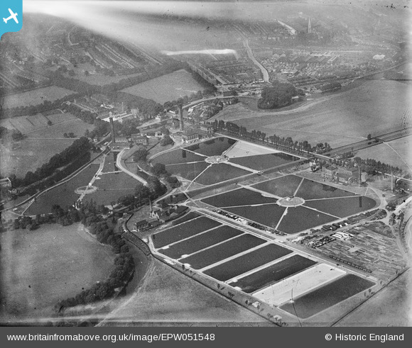
EPW051548 ENGLAND (1936). Lea Bridge Pumping Station and Filter Beds (Metropolitan Water Board), Lea Bridge, 1936
© Copyright OpenStreetMap contributors and licensed by the OpenStreetMap Foundation. 2024. Cartography is licensed as CC BY-SA.
Nearby Images (9)
EPW051548
, Lea Bridge, 1936")
EPW051546
, Lea Bridge, 1936")
EAW027651

EPW051545
, Lea Bridge, 1936")
EPW051547
, Lea Bridge, 1936")
EPW051549
, Lea Bridge, 1936")
EPW051980

EAW043554

EAW027652

Details
| Title | [EPW051548] Lea Bridge Pumping Station and Filter Beds (Metropolitan Water Board), Lea Bridge, 1936 |
| Reference | EPW051548 |
| Date | August-1936 |
| Link | |
| Place name | LEA BRIDGE |
| Parish | |
| District | |
| Country | ENGLAND |
| Easting / Northing | 535842, 186656 |
| Longitude / Latitude | -0.04005021094312, 51.56192466048 |
| National Grid Reference | TQ358867 |


