
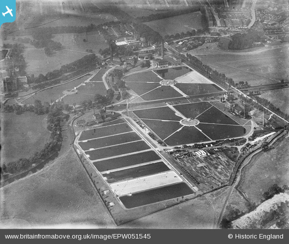
EPW051545 ENGLAND (1936). Lea Bridge Pumping Station and Filter Beds (Metropolitan Water Board), Lea Bridge, 1936
© Copyright OpenStreetMap contributors and licensed by the OpenStreetMap Foundation. 2024. Cartography is licensed as CC BY-SA.
Nearby Images (18)
EPW051545
, Lea Bridge, 1936")
EPW051549
, Lea Bridge, 1936")
EPW051547
, Lea Bridge, 1936")
EPW051980

EPW051546
, Lea Bridge, 1936")
EAW027651

EAW027649

EAW043554

EAW027648

EAW027650

EPW051548
, Lea Bridge, 1936")
EAW027652

EAW027647

EAW027644

EAW027646

EAW027643

EAW027645

EAW027642

Details
| Title | [EPW051545] Lea Bridge Pumping Station and Filter Beds (Metropolitan Water Board), Lea Bridge, 1936 |
| Reference | EPW051545 |
| Date | August-1936 |
| Link | |
| Place name | LEA BRIDGE |
| Parish | |
| District | |
| Country | ENGLAND |
| Easting / Northing | 536018, 186656 |
| Longitude / Latitude | -0.037512457353436, 51.561882235183 |
| National Grid Reference | TQ360867 |
Pins
Be the first to add a comment to this image!


