
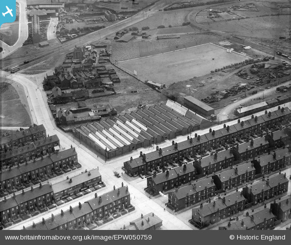
EPW050759 ENGLAND (1936). The Samuel Driver Ltd works and the surrounding residential area, Hunslet, 1936
© Copyright OpenStreetMap contributors and licensed by the OpenStreetMap Foundation. 2024. Cartography is licensed as CC BY-SA.
Nearby Images (8)
EPW050759

EPW050761

EPW050757

EPW050760

EPW050754

EPW050758

EPW050756

EPW050755

Details
| Title | [EPW050759] The Samuel Driver Ltd works and the surrounding residential area, Hunslet, 1936 |
| Reference | EPW050759 |
| Date | June-1936 |
| Link | |
| Place name | HUNSLET |
| Parish | |
| District | |
| Country | ENGLAND |
| Easting / Northing | 430328, 431117 |
| Longitude / Latitude | -1.539756037276, 53.775287354661 |
| National Grid Reference | SE303311 |
Pins
 John Wass |
Saturday 29th of November 2014 08:24:00 PM | |
Brick Collector |
Wednesday 25th of June 2014 09:29:05 PM |


